
(texte en français ci-dessous)
The Harborwalk part 1, April 15, 2022
Gray weather and rather cold temperature today after two sunny days.
I walked along the Harborwalk from Charlestown towards the locks that connect this part of the city to Joy Wharf, following in reverse the Walk in Boston #5, the historic Charlestown.
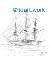
The USS Constitution frigate, one can actually see it before the locks if one leaves the Navy Yard and turns left after the Hoosac Stores, a now abandoned red brick building that has remants of ads painted on its south facade.
Where I sat down first, the frigate was too close to me and I didn’t have enough space to grasp it entirely. In the second place, I realized when I started to draw that there were a lot of ropes that connected the masts to the hull or to the other masts. Drawing gives new perspectives on things because you have to look at them in detail.
For the first time in a while, I decided to add color to my drawings but I kept working on them in black and white beforehand to make sure the lines I wanted were there. Not that they are exactly where and as precise as I would have liked them to be but it is not certain that in the end it would have been better. Just different. Like what you will see if you take the same path because everyone has their own ways, moods, moments.
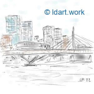
A little bit after that, there are beautiful views of the West End with a lot of sailboats in the foreground, most of them inhabited year-round. However, I didn’t want to show them but the buildings opposite, part of the Zakim Bridge and the new Washington Bridge under construction. It was therefore necessary to cheat on what is at water level, where the Charles River joins the sea, and it is an advantage of drawing versus taking a photo, not everything will be shown.
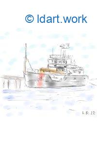
The second boat in this series was moored at the coastguard station at the far end of the North End. For some reason, I like to go there, it’s a quiet place where there are benches and a small maritime museum which presents Boston at the time of sailboats. The drawing was just a little extra fun.
To find this place, this time I followed in reverse the Walk in Boston #2, the other North End.
Both walks are self-guided and are on the boston.citywalks.space site which I regularly update.
Now, to see other sketches and read other stories:
- go to the blog, option sketches-croquis.

Le Harborwalk part 1, 14 avril 2022.
Le temps est gris et plutôt froid après deux jours de beau.
Depuis Charlestown et en suivant en l’envers la Promenade à Boston numéro 5, Charlestown l’historique, j’ai longé le Harborwalk vers les écluses qui relient cette partie de la ville à Joy Wharf.
La frégate USS Constitution, on la voit avant les écluses si vous partez du Navy Yard et tournez à gauche après le Hoosac Stores, un building en brique rouge pour l’instant abandonné qui a des restes de pubs peints sur sa façade sud.
Là où je m’étais d’abord assis, la frégate était trop près de moi et je n’avais pas le recul suffisant pour la saisir en entier. Au deuxième endroit, je me suis rendu-compte quand j’ai commencé à dessiner qu’il y avait beaucoup de cordages qui reliaient les mâts à la coque ou aux autres mâts. Dessiner donne une autre perspective sur les choses parce qu’il faut les regarder en détails.
Pour la première fois depuis un moment, je me suis décidé à ajouter de la couleur mais je continue à d’abord travailler en noir et blanc pour être sûr que les lignes que je veux sont là. Non pas qu’elles soient exactement où je voudrais et aussi précises que je les aimerais mais ce n’est pas certain qu’en fin de compte ce serait mieux. Juste différent. Comme ce que vous verrez si vous prenez le même chemin car évidemment, chacun porte en soi ses propres possibilités, ses humeurs, ses instants.
Il y a plus loin de belles vues du West End avec en premier plan des bateaux de plaisance qui pour la plupart sont habités à l’année. Ce n’est pourtant pas eux que je voulais montrer mais les buildings en face, une partie du Zakim Bridge et le nouveau pont Washington en train de se construire. Il a donc fallu tricher sur ce qu’il y a au niveau de l’eau, là où la Charles rejoint la mer et c’est un avantage du dessin sur la photo que tout n’a pas besoin d’être montré.
Le deuxième bâteau de cette série était amarré à la station de garde-côtes située à l’extrémité du North End. Pour une raison ou pour une autre, j’aime aller là, c’est un endroit tranquille où il y a des bancs et un petit musée maritime qui présente Boston au temps des voiliers. Le dessin n’était qu’un petit plaisir supplémentaire.
Pour trouver cet endroit, suivez cette fois-ci et encore à l’envers la Promenade à Boston numéro 2 , l’autre North End.
Les 2 sont auto-guidées et sont sur le site de boston.citywalks.space que je mets à jour régulièrement.
Maintenant, pour voir d’autres croquis et lire d’autres histoires:
- allez sur ce blog, option sketches-croquis.